

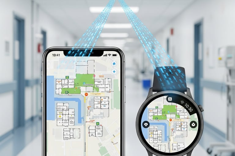
Pedestrian Indoor Navigation
Leading-edge technology for pedestrian indoor navigation solutions on smartphones and wearables

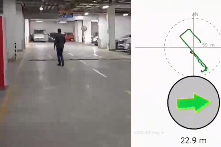
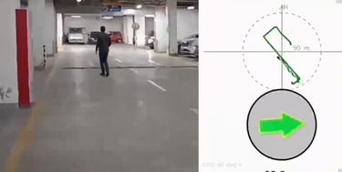
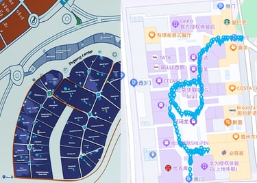
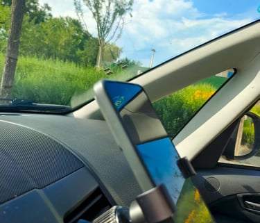
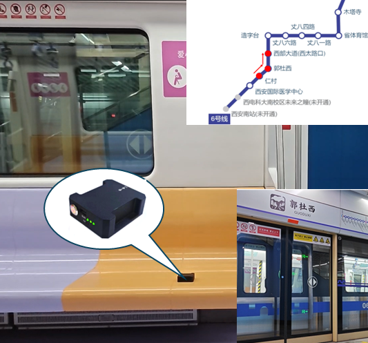
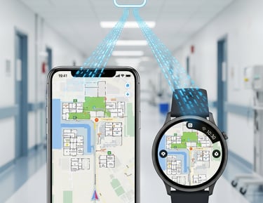
Underground Parking Car-Finding
Background
Underground parking is often confusing, with weak signals that make it easy to forget where you parked. Finding your car can be time-consuming and frustrating. Traditional solutions require costly infrastructure and offer limited coverage.
Our Solution
Our pedestrian navigation runs entirely on your smartphone, using only its built-in compass and IMU—no garage upgrades or wireless signals needed. With novel trajectory retracing techniques, it guides you back to your car along the same or optimal route, offering a truly plug-and-play, stress-free car-finding experience.
sgFusion
Recommended Products
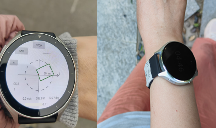
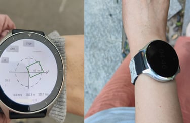
Smart Watches, Start Moving Instantly, No GPS Wait
Background
Smartwatch users often experience delays when starting a workout due to GPS positioning. Even in good network conditions, they may have to wait a few seconds, and sometimes the wait is even longer. This delay impacts on the overall experience. Additionally, GPS signals can be blocked in dense forests or among high-rise buildings, affecting the accuracy of activity data.
Our Solution
Our PDR solution on watches enables instant positioning, allowing workouts to start without waiting for GPS. Activity data is available immediately, and retraced trajectory and location information is fully preserved, greatly enhancing the user experience. Even in areas with weak GPS signals, such as dense forests or high-rise buildings, it delivers accurate relative position, pace, step rate, distance, and attitude data for reliable tracking.
sgWalk
Recommended Products
Fast Delivery to Unfamiliar Addresses
Background
Couriers, express deliveries, and food services often face complex indoor environments, such as malls, residential buildings, and office towers, where GPS is unavailable or heavily blocked and indoor maps are absent. Strict delivery timeframes further increase the challenge.
Our Solution
Our pedestrian navigation technology offers continuous, on-device guidance and intelligent route planning for efficient deliveries. In recurring delivery scenarios, walking traces and environmental data can be crowdsourced to the cloud, where AI mapping technology enables fast and accurate indoor map updates. Delivered as a software algorithm library, the solution can be embedded into smartphones, rider helmets, and other hardware platforms for flexible deployment.
sgWalk
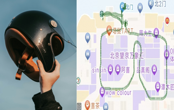
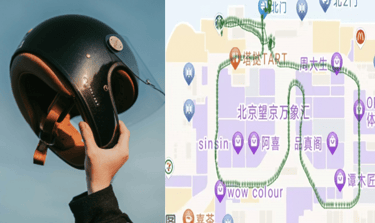
Recommended Products
Location Sharing, Family Safety
Background
In crowded places such as shopping malls, museums, amusement parks, train stations, and tourist attractions, families, especially those with young children or teenagers, can easily become separated. When going out, parents not only care about whether their children have arrived safely but also want to know their real-time activity range and exact location.
Our Solution
Our pedestrian positioning solution, running on smartphones or smartwatches and paired with a membership data service, enables seamless location sharing among family members. Whether on the way or during activities, families can stay updated on each other’s whereabouts, reducing the risk of separation. Location sharing can be turned on or off at any time, ensuring both safety and privacy, and adding a reliable layer of protection to every family outing.
sgGroup
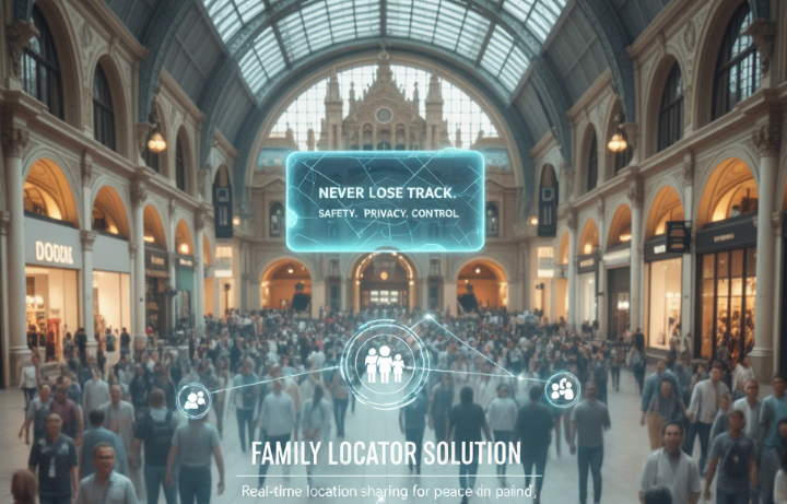

pintraMap
Recommended Products
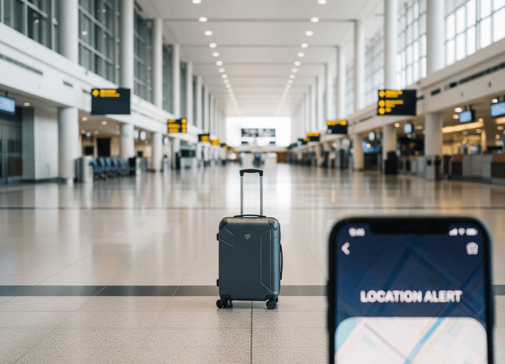
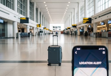
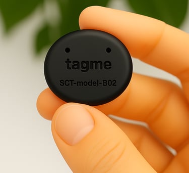
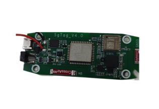
Asset Indoor Tracking and Anti-loss
Background
At airports or train stations, luggage can easily be misplaced or taken by mistake once it’s out of sight. In hospitals or laboratories, valuable instruments often move between rooms, making their location hard to track. Traditional tracking methods struggle in indoor environments, leaving real-time visibility and management a challenge.
Our Solution
We provide a comprehensive indoor asset tracking and anti-loss solution, consisting of a hardware tag and cloud-based membership services. By leveraging IMU sensors, Wi-Fi hotspot data, and detailed indoor maps, the hardware tag enables real-time monitoring of your luggage or equipment. Simply attach a tag device to your asset and subscribe to the membership service to instantly track its location—ensuring security, enhancing management efficiency, and eliminating uncertainty indoors.
TagMe
pintraMap
Recommended Products
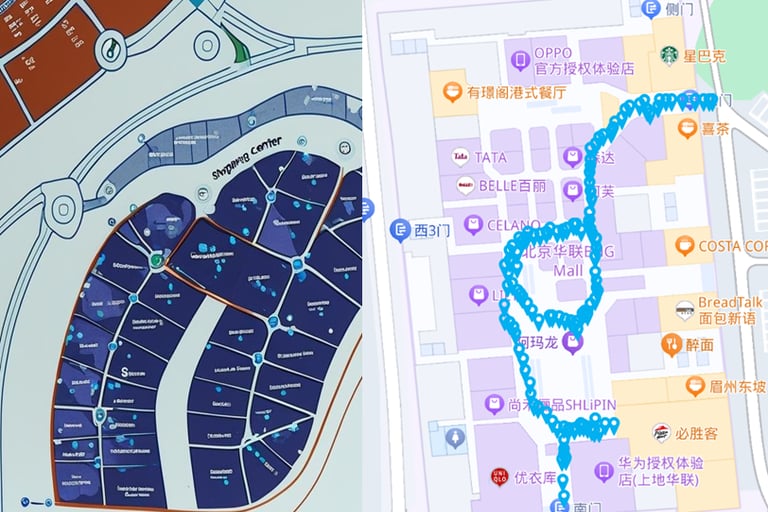
Harvesting & AI Indoor Mapping
Background
Indoor venues are diverse and numerous, making manual indoor map creation costly and time-consuming. Collected Wi-Fi hotspot data is often vast and unstructured, requiring significant effort to extract useful location information, which delays the availability of high-quality maps for indoor positioning applications.
Our Solution
Using PDR (Pedestrian Dead Reckoning) technology, we accurately determine the true positions of harvested Wi-Fi hotspots. By combining these positions with a simple floor plan, we can rapidly generate high-precision digital indoor maps. These maps, in turn, enable seamless indoor positioning through map matching, providing fast and accurate location results.
sgHarv
Recommended Products
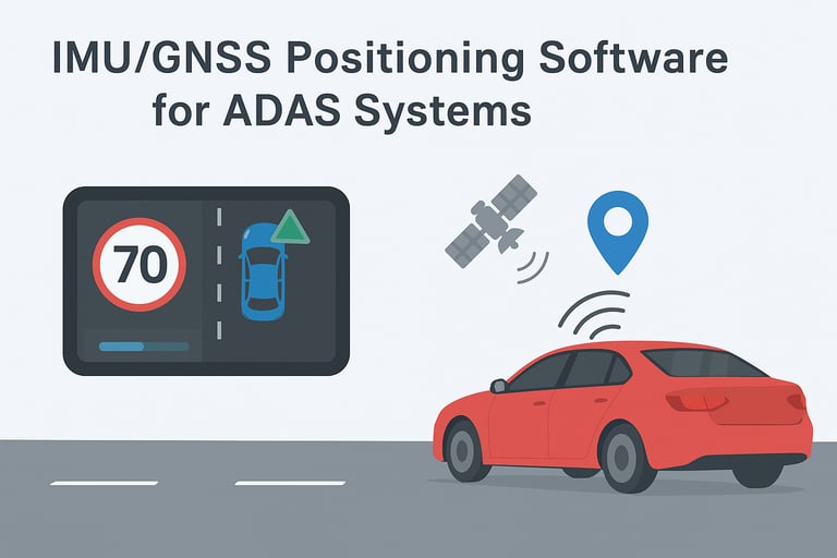
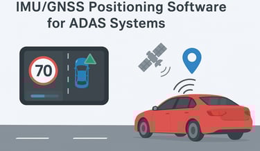
Car Navigation
Seamless navigation solutions for vehicles by IMU/GNSS tightly couple integration
Aftermarket Car Navigation Hardware Module
Background
In challenging environments such as tunnels, urban canyons surrounded by tall buildings, and underground parking lots, GPS/BeiDou signals are often blocked or suffer from severe multipath effects, resulting in significant positioning errors and unreliable navigation.
Our Solution
A compact hardware module with tightly coupled IMU/GNSS algorithm delivers continuous position, velocity, and attitude even in GNSS-denied environments. It supports high data rate, hot reset capability in underground garages, and optional RTK for enhanced accuracy. The module is easily integrated into smart mirrors, HUDs, dashcams, and OBD devices.
InsCore
LaneTo
Recommended Products
High-precision Navigation for Autonomous Vehicles
Background
In environments with multipath interference, temporary GNSS outages, or adverse weather, conventional navigation systems struggle to deliver stable, high-precision positioning and attitude, compromising overall system reliability and safety.
Our Solution
Our solution uses tightly coupled IMU/GNSS integration to provide continuous, high-precision position and attitude, even in challenging environments. Dual-antenna RTK delivers accurate heading, while integrated 4G ensures reliable communication. The system also outputs multi-port hardware pulse timing derived from PPS at tens of Hz, enabling precise synchronization of multiple sensors throughout the hardware system.
Recommended Products
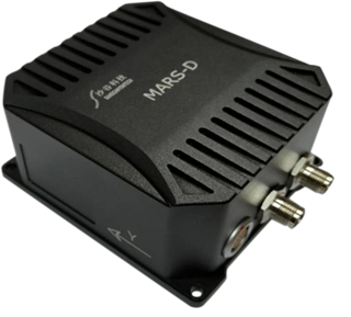
MarsD


SGP01
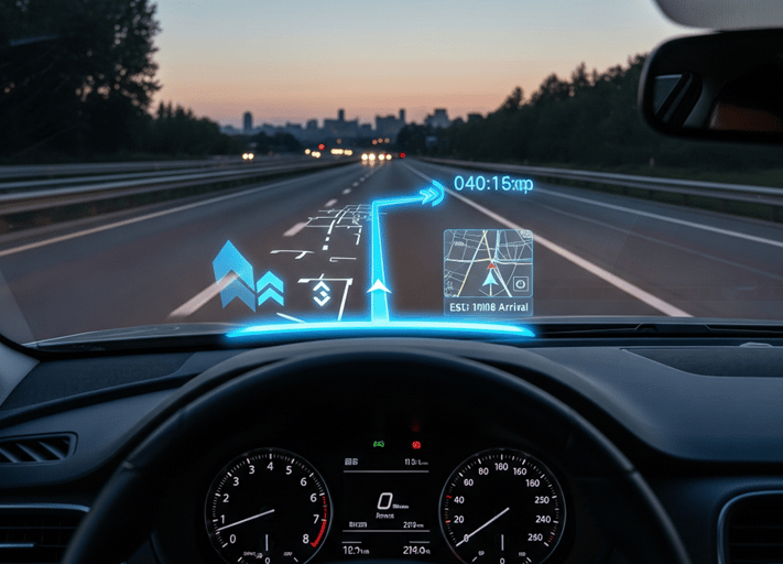
ADAS in-dash Navigation Software IP
Background
Automotive in-dash navigation systems require high performance not only in GNSS-denied, interference-prone, or multipath environments, but also demand strong functional reliability.
Our Solution
Delivered as an embedded software library (Software IP), our solution can be flexibly deployed on a variety of main processor platforms. The library features functional unit diagnostic interfaces and failure warnings, supports hardware separation, and can leverage existing hardware for flexible integration. In addition to robust high-precision positioning and navigation, it provides driver behavior monitoring and multi-level collision warnings, offering comprehensive safety support for the vehicle.
DRCoreIP
Recommended Products
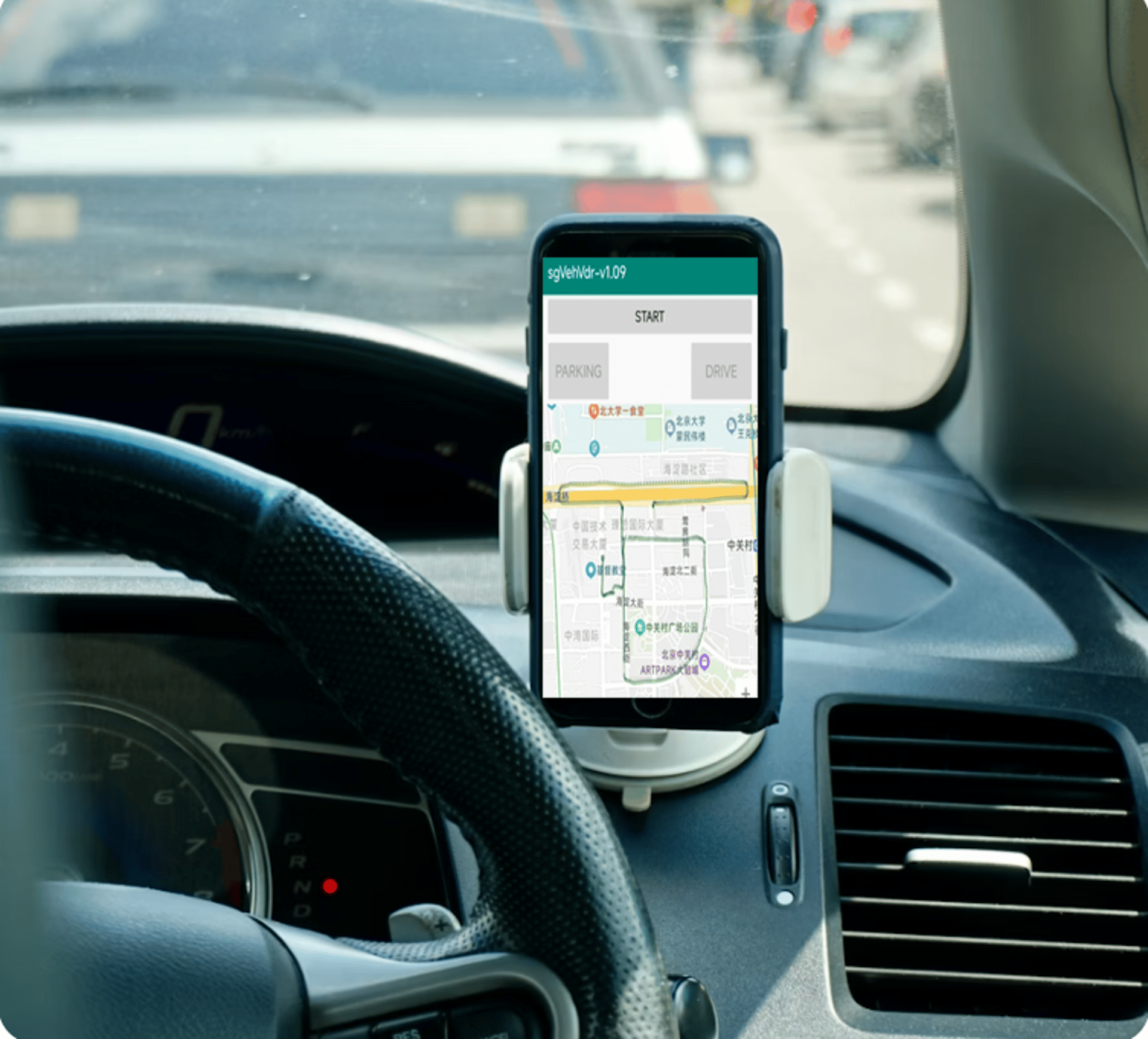
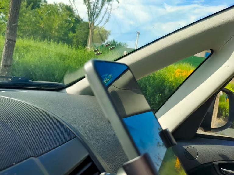
Navigation Software Library on Smartphone
Background
Smartphone navigation often suffers from limited satellite signals, resulting in delayed map matching or users getting lost, which degrades the overall experience.
Our Solution
Our solution leverages IMU/GNSS integration to provide continuous position and velocity even in difficult conditions. Delivered as a software library (Software IP), it can be deployed on smartphone platforms, supporting both .so and .lib. The software algorithm uses the phone’s existing IMU and GNSS sensors, requiring no hardware modification and ensuring broad compatibility. It provides reliable low-level positioning data to support application-layer map matching, allowing users to instantly obtain accurate location when exiting a parking garage, greatly improving navigation experience.
sgVDR
Recommended Products

Attitude Detection and Control
High-precision and reliable attitude control driven by advanced inertial algorithms
Rapid Attitude Sensing for Free-Flying Drones
Background
Drones face challenging environments such as rapid maneuvers, weightlessness, wind disturbances, and temperature fluctuations caused by propellers, which can destabilize attitude control and affect flight safety and precision.
Our Solution
Our solution supports both rotary-wing and fixed-wing drones, using attitude algorithms specifically optimized for UAV platforms. It provides 360-degree roll measurement and maintains stable 3D attitude tracking during hovering, rapid maneuvers, emergency stops, and rolls. The hardware is lightweight and delivers high data rates, meeting the demanding requirements of UAV attitude measurement.
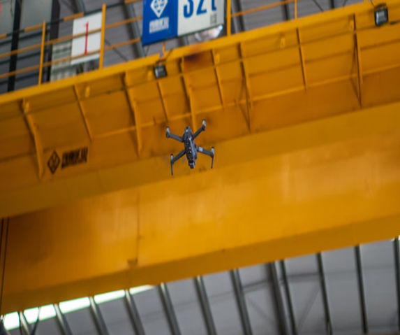
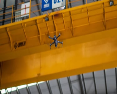
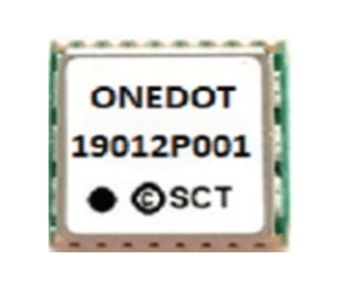
OneDot
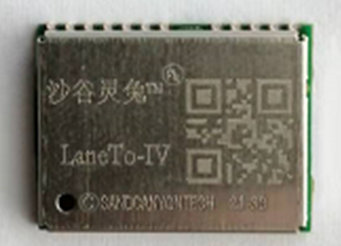
LaneTo
Recommended Products
Robust, Low-Latency Attitude for Robotics
Background
Robotic dogs experience rapid body movements and attitude changes when moving quickly, jumping, or navigating complex terrains. Inaccurate or delayed attitude measurements can compromise stability and task performance.
Our Solution
The solution provides high-precision 3D attitude measurement with data rates up to 500 Hz and low latency, effectively mitigating the issue of IMU signals being overwhelmed by noise during slow movements. It captures real-time attitude changes of robotic dogs, ensuring stable control and precise motion execution during jumps, rotations, or slow movements. The lightweight hardware allows for easy integration into a variety of platforms, further enhancing overall stability and reliability.
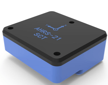
sgAHRS
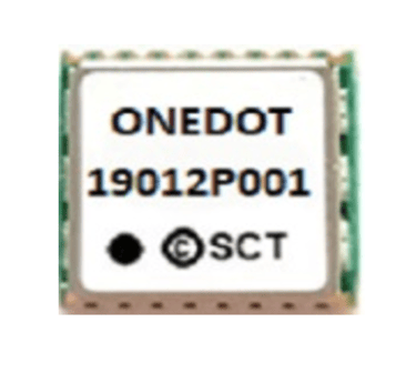
OneDot


Recommended Products
Attitude and Altitude Stabilization of Meteorological Balloons
Background
Meteorological balloons experience reduced sensitivity to altitude changes at higher altitudes due to smaller pressure variations. Low-temperature conditions challenge sensor accuracy, requiring temperature compensation. While the overall rotation of high-altitude balloons is slow, wind shear can induce continuous rotation or swinging, demanding precise attitude and altitude stabilization.
Our Solution
Our solution integrates IMU, barometer, and RTK GNSS data through a Kalman filter-based attitude algorithm, forming a stable platform for balloon altitude and attitude control. Temperature compensation algorithms reduce hardware costs while maintaining accuracy. Equipped with Bluetooth, the platform can transmit real-time attitude data to the main control unit, ensuring reliable monitoring during high-altitude missions.
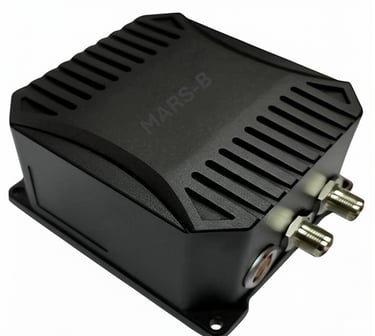
Mars-B


Recommended Products
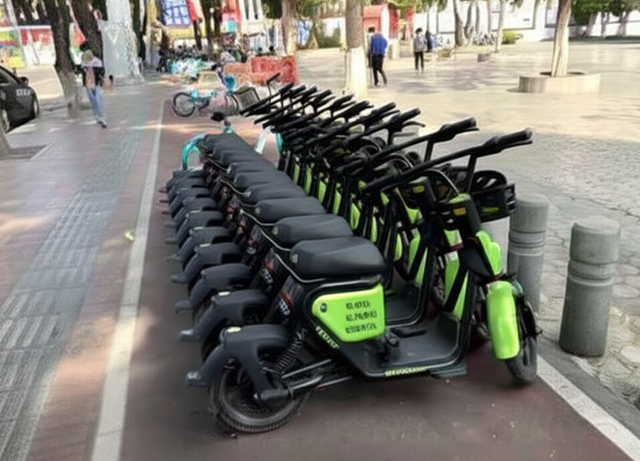
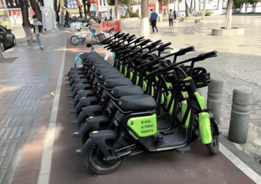
Sharing E-Bikes
Background
With the rapid growth of shared e-scooters and e-bikes, urban and campus vehicle dispatching and parking management face significant challenges. Traditional GPS positioning often encounters blind spots in buildings, under bridges, and other areas, leading to inaccurate vehicle distribution and reduced management efficiency.
Our Solution
Using low-power IMU/GNSS fused positioning technology, our hardware module solution enables precise location tracking and parking management for shared e-scooters and e-bikes. The system not only significantly improves dispatch efficiency but also supports standardized 90-degree parking and long-term topple alerts, ensuring orderly vehicle placement while providing coverage in areas where traditional GPS may fail.
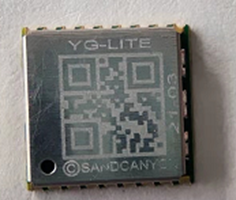
YG-Lite
Recommended Products
Subway Speed and Track Integrity Monitoring
Background
Ensuring the safety of metro trains and tracks in busy urban transit systems is a significant challenge. Traditional inspection methods are often time-consuming and rely on bulky equipment, providing limited data that hinders effective preventive maintenance.
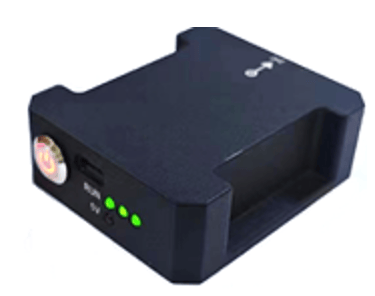
Our Solution
Our SpeedO solution is a portable speed tracking device specifically designed for railway and metro. As a core component of the speed tracking and rail inspection system, it enables railway maintenance teams to perform precise and efficient inspections. Beyond measuring train speed and inter-station distances, SpeedO’s rich data supports advanced rail inspection metrics including track deformation angles, uneven impact forces, and other motion analytics, allowing the system to detect nearly five times more types of rail anomalies than before.
SpeedO
Recommended Products
Emergency Rescue
Background
During emergencies such as fires, floods, or earthquakes, rescue operations often face challenges like blocked GNSS signals and disrupted communication. In such scenarios, both operational efficiency and responder safety are equally critical.
Our Solution
The SgTag solution works seamlessly in both indoor and outdoor environments, with devices that can be worn on the feet, waist, helmet, or chest. Multiple units form a network via a proprietary protocol, continuously maintaining relative positioning including distance and direction, with the command center. Equipped with Bluetooth and NB-IoT communication, SgTag ensures efficient teamwork while fully safeguarding the safety of every rescue personnel.
SgTag


Recommended Products
Indoor Map Data Service -- pintraMap
Background
Indoor maps have limited coverage and GPS signals are often blocked, resulting in poor navigation experiences for deliveries, pickups, personnel management, and family or social scenarios.
Our Solution
pintraMap indoor map data service automatically delivers maps to smartphones, smartwatches, or TagMe when subscribed users enter covered areas. Devices match with indoor navigation functions to provide precise guidance. With authorization, locations can also be uploaded to the cloud for real-time viewing. The service enhances deliveries, pickups, and meetups, helps parents keep track of children, and supports enterprises in managing personnel with geofencing.
pintrMap
Recommended Products
We advance positioning technology to deliver intelligent mobility for pedestrians, wearables, vehicles, and robotics indoors and outdoors. Leveraging advanced algorithms, sensor fusion, and AI-driven engines, our solutions offer high-performance, low-power spatial computing across mobile and embedded platforms. Pinnobot enables real-time tracking and posture sensing to build a connected, inclusive intelligent spatial future.
hello@pinnobot.com
© 2025. Pinnobot. All rights reserved.

Stay Connected
Quick links
Company Info
9272 Jeronimo Rd., Irvine, CA, US
+1-949-4349522
hello@pinnobot.com
hello@pinnobot.com
A409-12 Xinxi Rd, Haidian, Beijing, China
+86-10-88118077